
Creating 3D maps of all city streetscapes is paramount to the future of self-driving cars. While we’re at it, can it also be helpful for cities?
![[Photo: courtesy Carmera]](https://assets.fastcompany.com/image/upload/w_394,h_221,c_fit,f_auto,q_auto:best,fl_lossy/wp-cms/uploads/sites/4/2017/06/2-carmera-1024x576.jpg)
![[Photo: courtesy Carmera]](https://assets.fastcompany.com/image/upload/w_707,h_397,c_fit,f_auto,q_auto:best,fl_lossy/wp-cms/uploads/sites/4/2017/06/6-carmera-1024x576.jpg)
Autonomous vehicles require a constant feed of data about their environment, in order to navigate that environment safely. It’s not enough that a car has computer vision—it also needs 3D maps of the streetscape to confirm what it’s seeing. And creating those 3D maps is an enormous task: It means gathering and constantly refreshing visual data for every street. In the U.S. alone, that’s over 4 million miles of roads.
Yet companies have been popping up to take on this 3D mapping work, and as a result an interesting use case has arisen. The technologies that are building the infrastructure for self-driving cars may also prove to be valuable to cities themselves—and the architects and developers who build them.
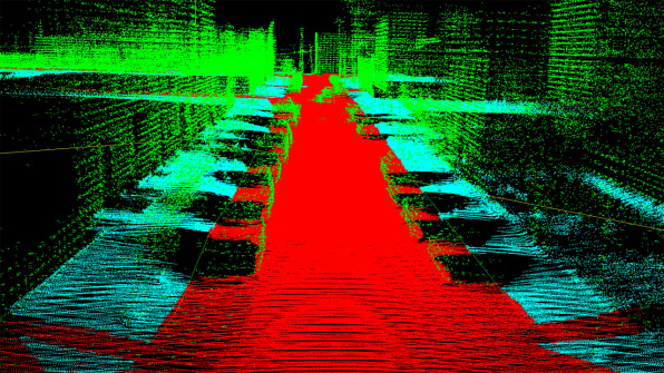
On the forefront of that idea is the start up Carmera, which launched on Monday. The company has a mission of gathering real-time 3D-mapping data that is being used by the makers of autonomous vehicles, but making it accessible for anyone. It joins third-party companies like TomTom and Nokia’s Here (recently acquired by BMW, Daimler, and Audi) that are providing this data to car companies, allowing them to compete with companies like Google that has its own data for AV development. But with a trove of city data at its fingertips, Carmera isn’t relegating itself to the car market—it is also widening its consumer base to include city officials, builders, and planners.
In fact, the first product Carmera has made available is for analyzing a build site, to be used by the construction and real-estate industries. At the moment, Carmera is focused on selling the product to companies in the private sector, but Ro Gupta, the company’s CEO and cofounder, says that they are also in talks with city agencies about how the data could be useful to them in the future, particularly in terms of Smart City and mobility initiatives.“We’ve been crawling the streets of New York with our sensors for over a year,” says Gupta. “So now we have really good data based on actual observations on pedestrians, versus the inferred data that you might get from a subway turnstile or cell-phone data. We have actual observations on pedestrian foot traffic across all months of the year and across all different hours of the day.”

Gupta started the company two years ago with cofounder Justin Day, formerly the CTO of the 3D-printing startup Makerbot. Since then, they’ve been working on developing their own software that uses machine vision and data processing to create 3D streetscapes that refresh either once a day, weekly, or monthly, depending on the location. They’ve raised $6.4 million in funding from venture capital firm Matrix Partners, with participation from other like MakerBot Industries’ Bre Pettis and investor Semil Shah of Haystack.Carmera’s mode of operation marries what both major tech companies and smaller crowdsourcing efforts have been doing to gather 3D mapping data. Google, with its mobility project Waymo, and Uber have already started mapping out the country, outfitting their own fleets of cars with sensors and gathering the data city by city. Similarly, Carmera’s own LiDAR mapping vehicles roam New York City and gather visual data.
But like initiatives such as OpenStreetMap foundation, Carmera also recruits others to gather data simultaneously, by attaching Carmera’s visual monitoring sensors to their vehicles. Called fleet partners, these are companies that already have a fleet of vehicles taking routes through the city on a daily basis. Though the storage company MakeSpace is the only partner Carmera has shared publicly, Gupta points to companies with package delivery trucks or service vans as prime partners. In return for attaching the sensors, Carmera provides fleet partners with monitoring data about their vehicles’ safety and efficiency. (One thing Carmera’s partners have found especially useful is using the tracking technology to fight parking tickets—which can total to more than seven figures for many delivery companies, according to Gupta.)

In turn, the fleets give Carmera images of the city streets on a regular basis, providing it with a base map that is made even more accurate with the more expensive sensors and LiDAR technology that equip Carmera’s own cars. The 3D maps created by and constantly kept up-to-date with this information can be used for autonomous vehicles as they continue to develop. In the meantime, the company’s first product, Carmera Site Intelligence ($499 per export), will provide architects, engineers, and planners with spatial data and location analytics for construction sites. It makes it possible for an architect in Europe, for example, to scope out a site it is considering in downtown New York City just by downloading a zip file with 3D imagery and a panoramic viewer.The data could also be useful in the design process directly, particularly for firms using 3D contruction software. “In a Revit or BIM environment, they could actually develop the job itself almost like the old style way of using trace paper to sketch on top of a photo of the site,” Gupta says. “In our case the ‘photo’ would be the dimensions of the site itself.”
The Philadelphia-based firm Francis Cauffman Architects is the only beta partner that Carmera is making public at this time. Ken Kramer, a principal there, describes the scenario that the data will be most useful: in cutting down on the need for ongoing site visits, gathering physical site data like photos or waiting for third-party data for weeks. Instead, they have been exporting Carmera’s data right away and using the imagery to show the environment while designing their projects.
Longer-term, Carmera has started gathering data in other major cities—something Gupta says they feel well equipped for after doing so in New York City where the streets are constantly changing and tall buildings often make it difficult to get accurate imagery. By the time autonomous vehicles make it to the streets of city’s across the U.S., Carmera hopes to have them all mapped out.
–
This article first appeared in www.fastcodesign.com
Seeking to build and grow your brand using the force of consumer insight, strategic foresight, creative disruption and technology prowess? Talk to us at +9714 3867728 or mail: info@groupisd.com or visit www.groupisd.com

